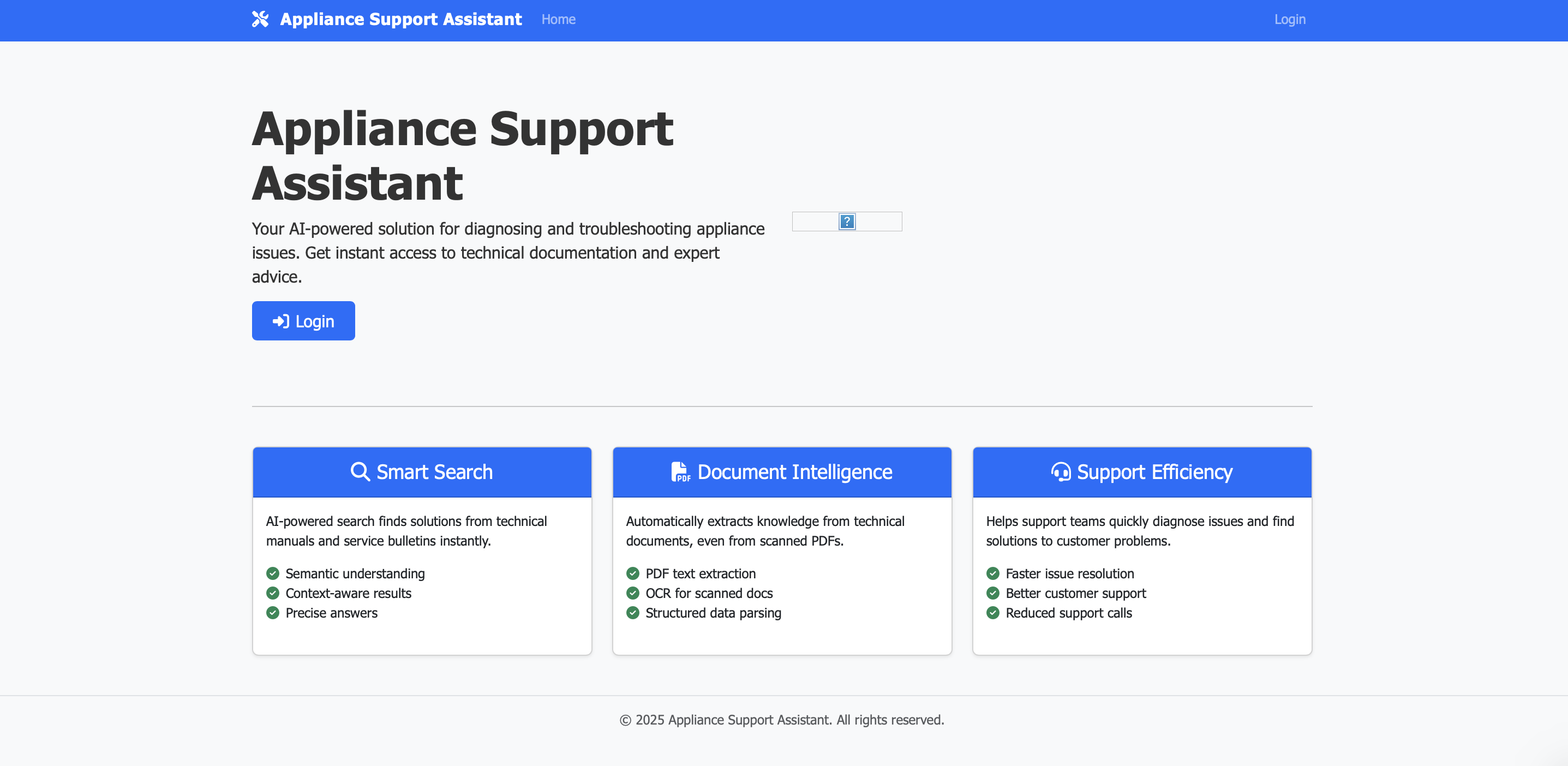
I’m a Data Engineer and Geospatial professional who has led projects ranging from end-to-end ETL implementation to AI chatbot development and spatial modeling. In my previous roles—Associate Software Engineer at Precisely and Project Lead Developer at A8 Consulting—I designed and deployed cloud-based data solutions, streamlined data pipelines, and integrated sophisticated analytics to help teams uncover actionable insights. From harnessing Python to automate ingestion pipelines, to applying GIS techniques for geospatial intelligence, I’ve focused on turning complex datasets into practical business value.
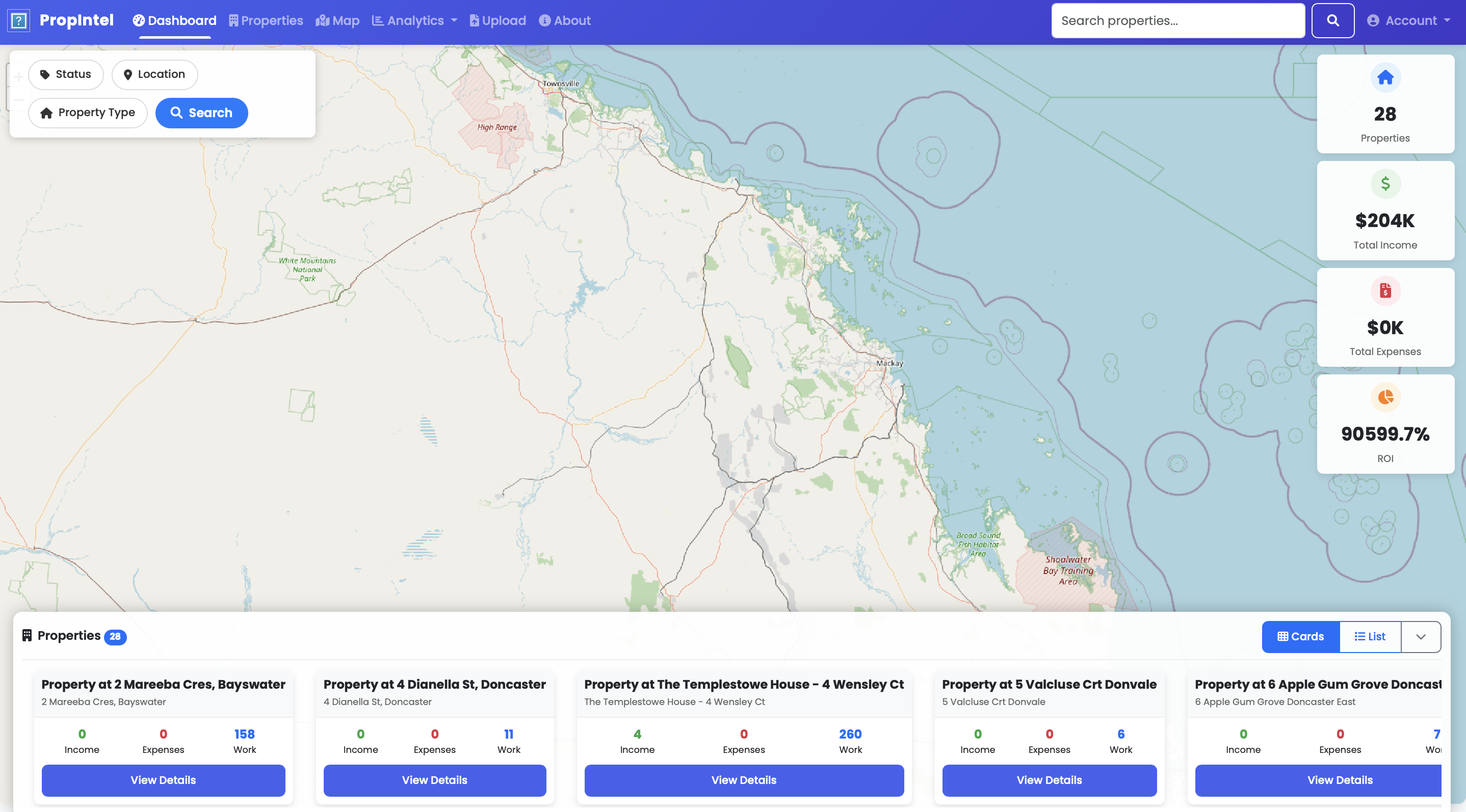
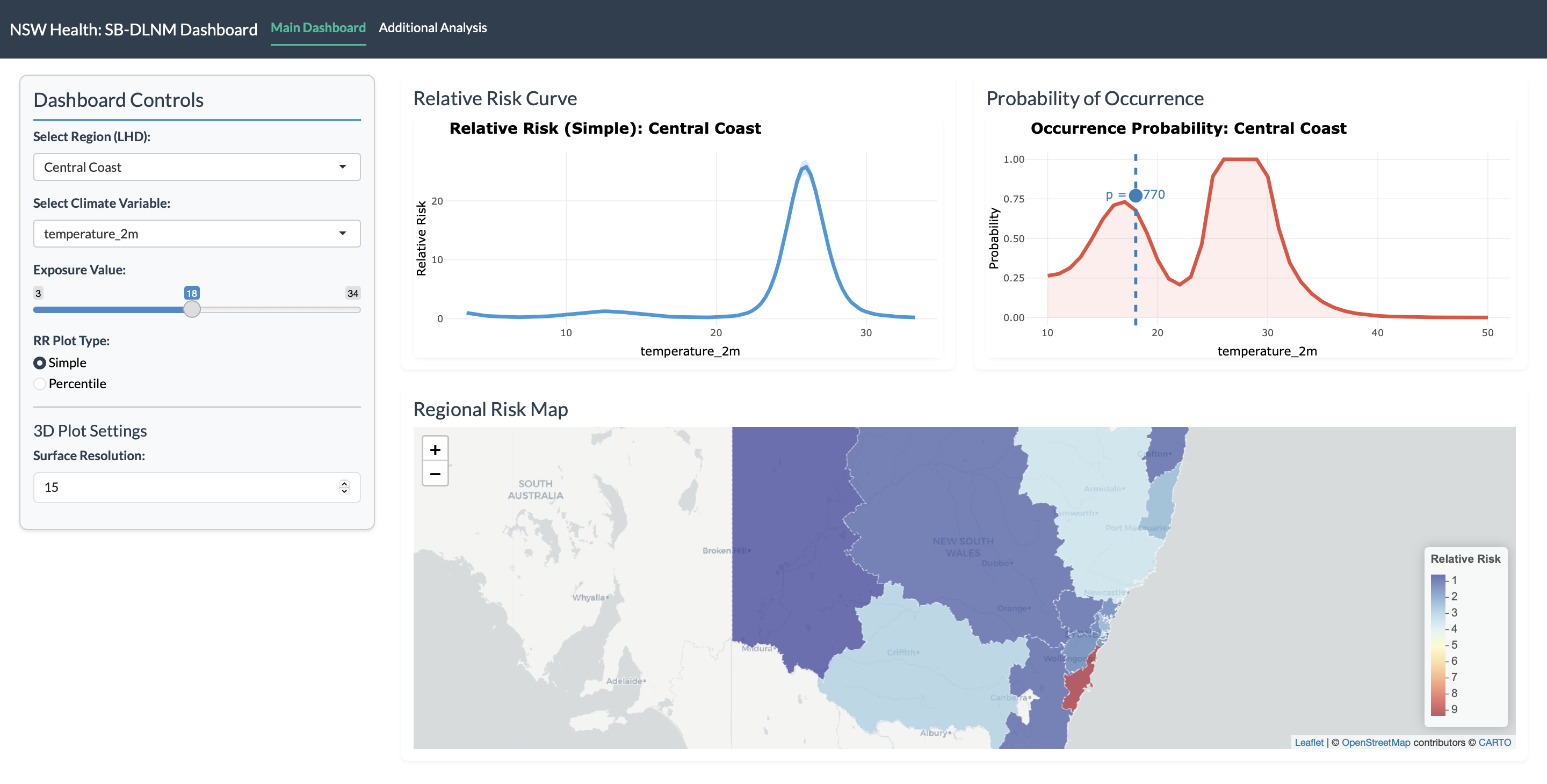
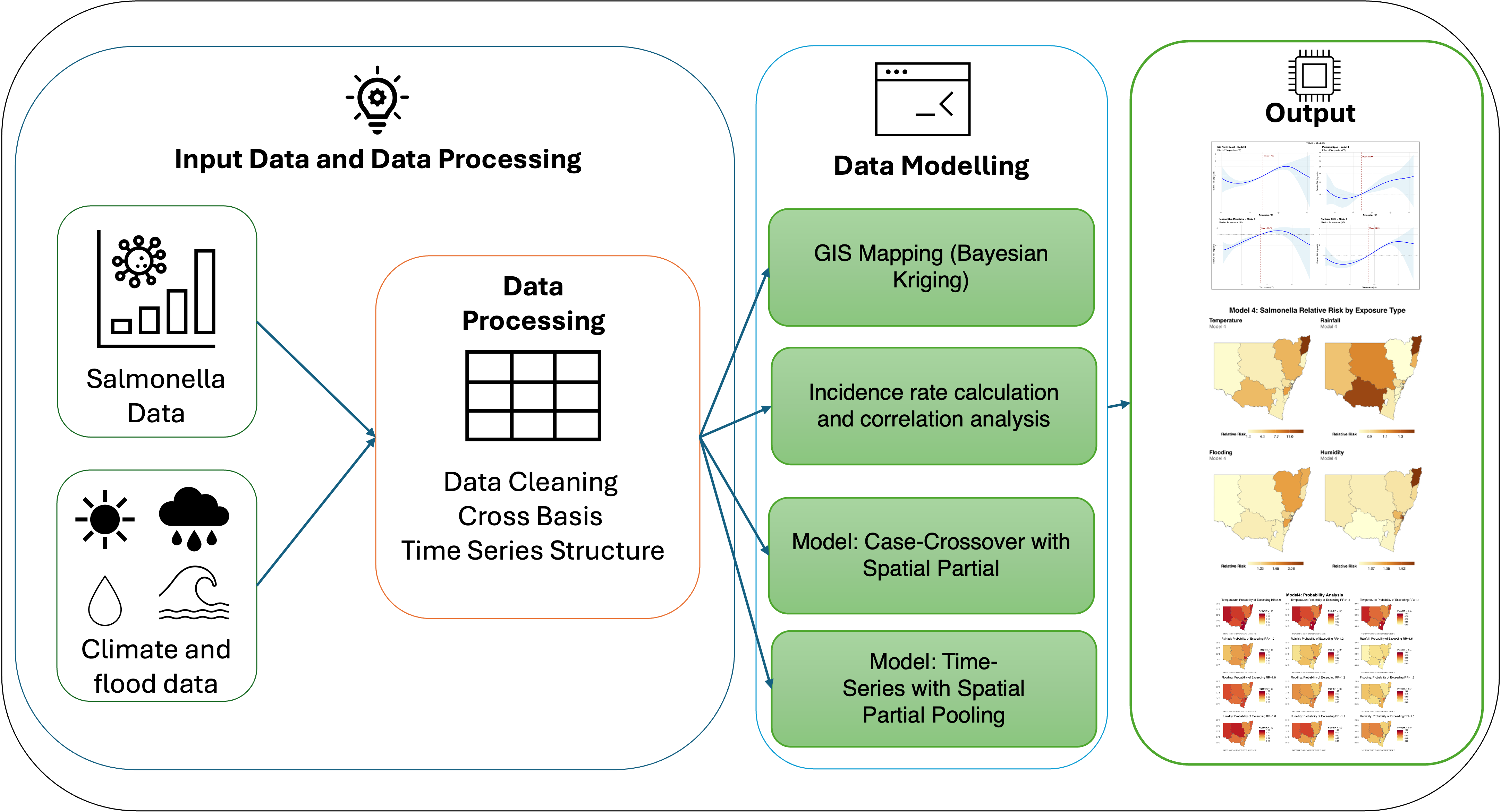
My projects reflect a balance of innovation and real-world impact: crafting AI-driven chatbots that optimize documentation workflows, building property management systems that unify data for more informed decisions, and leveraging Bayesian methods to better understand climate-related health risks. Through each initiative, I’ve developed a broad technical toolkit that includes Python, SQL, AWS, Azure, and visualization platforms like Power BI or Tableau, complemented by expertise in ArcGIS and QGIS for spatial analysis.
Academically, I hold a Master of Data Science from Monash University, where I received the Sir John Monash Scholarship for Excellence, as well as an MSc in Geoinformatics (Gold Medal) from TERI School of Advanced Studies and a BA (Hons) in Geography from Delhi University. These achievements underpin my passion for bridging data engineering, cutting-edge analytics, and geospatial insights to deliver solutions that shape better decisions in both business and research settings.
{ data.map(item => visualize(item)) }
import geopandas as gpd
const map = L.map('container')
GPA: 3.4/4.0 - Advanced coursework in machine learning, data visualization, and statistical modeling.
CGPA: 9.32/10 - Specialized in remote sensing, spatial analysis, and geospatial modeling.
CGPA: 8.1/10 - Multiple 3rd-place finishes in departmental rankings.
Leading the development of data analytics solutions, ETL pipelines, and integration of geospatial technologies for diverse clients.
Processed and analyzed warranty claims, created Power BI dashboards, and optimized operational workflows through data analysis.
Built scalable data integration solutions with Python, Jenkins, and AWS while integrating GIS capabilities with advanced analytics.
AI-powered chatbot for conversational access to appliance manuals, using lightweight language models, FAISS for semantic search, and Tesseract OCR.
Property management platform automating data ingestion with interactive dashboards for real-time insights into expenses and maintenance tasks.
Analysis of influenza cases alongside climate data using Spatial Bayesian Distributed Lag Non-Linear Models to quantify climate-influenza relationships.
32-year study investigating correlations between temperature, rainfall, floods, and Salmonella outbreaks using Bayesian spatiotemporal methods.
An interactive Shiny dashboard visualizing two decades of migration-driven demographic changes in Victoria, Australia. Combines choropleth maps, Sankey diagrams, clustering, and heatmaps to highlight how ethnic communities shift over time and across LGAs.
I'm always open to discussing new projects, opportunities, or partnerships in the fields of data science, geospatial analytics, and visualization.
Melbourne, Australia
fzlkhan0@gmail.com